Search
Close this search box.
Search
Close this search box.

Member Spotlight: the Columbia River Gorge Commission

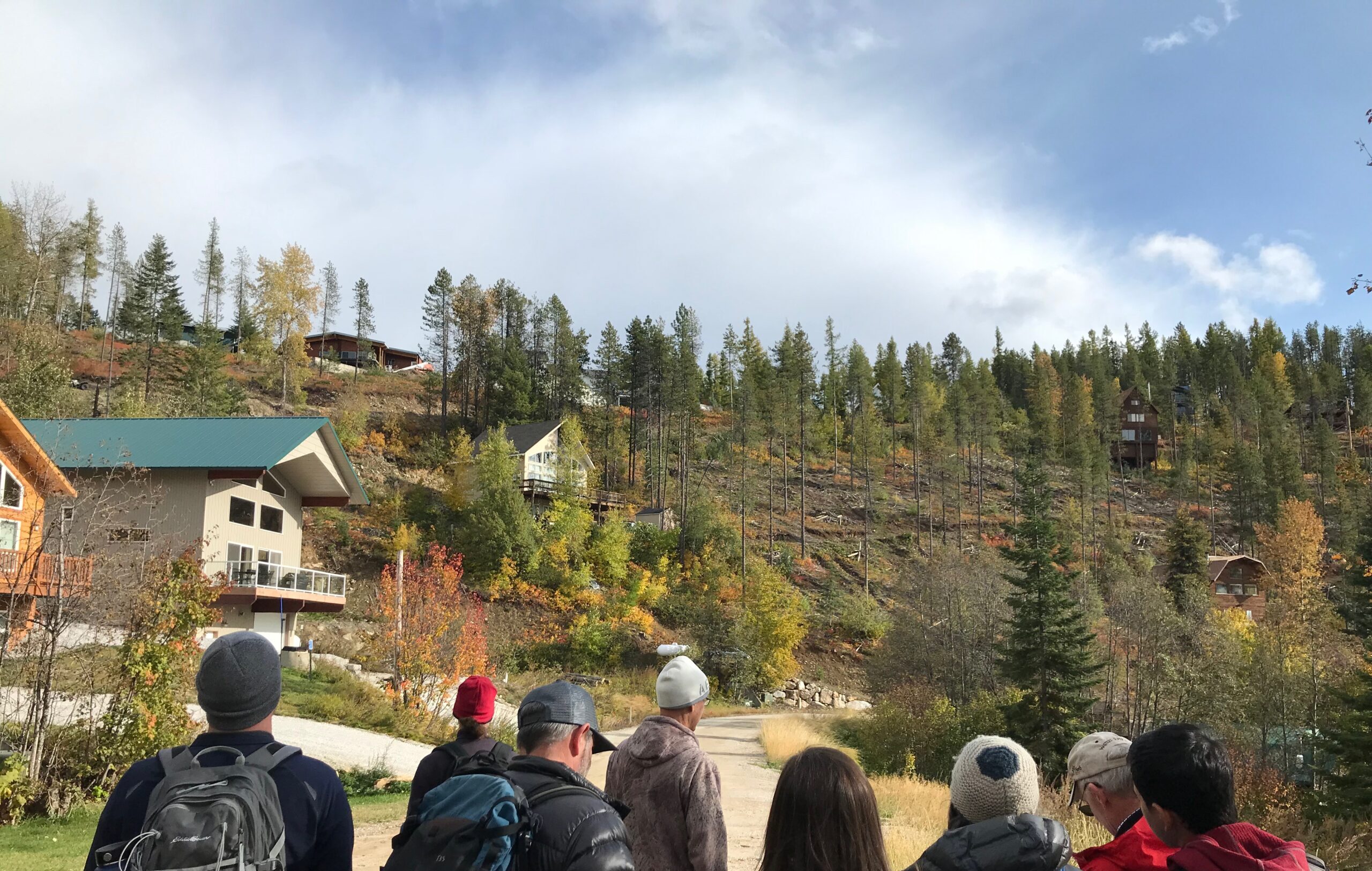
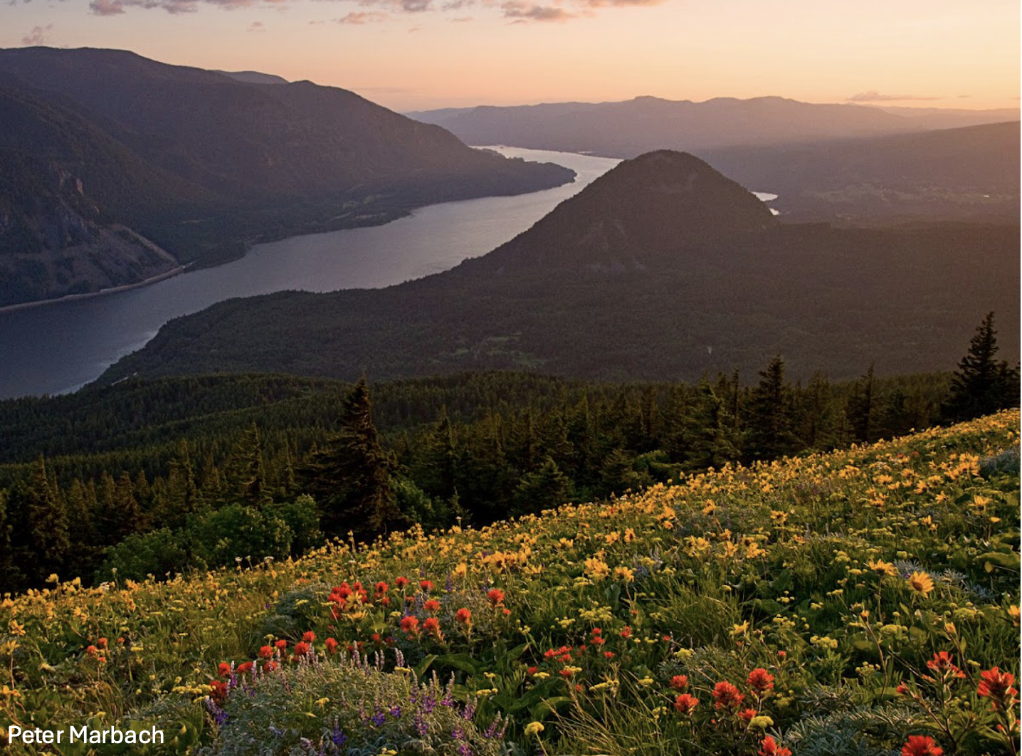
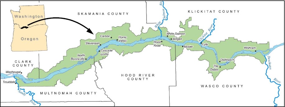
If you’ve ever had the chance to travel along the western Columbia River, which forms the border between Washington and Oregon, you’ve likely found yourself in the Columbia River Gorge National Scenic Area (NSA). Encompassing 292,500 acres and 85 miles of the Columbia River, it is the largest and most unique NSA in the country. Heading east from Washougal, WA, or Troutdale, OR, you slowly transition from a temperate marine climate, through a temperate rainforest, into an arid shrub-steppe landscape. Along the way, you encounter communities like Hood River, OR and White Salmon, WA, recreation hotspots like Multnomah Falls, or “The Wall” (where the hard-core windsurfers go), and agricultural lands ranging from orchards to tree farms to cattle ranches. It’s no accident that the scenic beauty of the Gorge has resulted in more than a century of growing popularity and development pressure. The Columbia River Gorge Commission (CRGC) is the agency responsible for ensuring the unique qualities of the NSA remain intact for current and future residents and visitors.

The Gorge Commission joined WAFAC in 2022. Lisa Naas Cook, the Commission’s Climate Program Manager, spoke with us about the agency and helped us better understand how WAFAC has been a valuable partner in her work. Here are some of the highlights of what Lisa shared with us.

Map of the Columbia River Gorge National Scenic Area. Image credit: Columbia River Gorge Commission (CRGC)

The Gorge Commission has a dual mandate set by Congress.

Passed by the United States Congress and signed by President Ronald Reagan in 1986, the Columbia River Gorge National Scenic Area Act was the culmination of escalating conservation efforts in the late 1970s. The Act set out two purposes:

  1. To establish a national scenic area to protect and provide for the enhancement of the scenic, cultural, recreational, and natural resources of the Columbia River Gorge; and 
  2. To protect and support the economy of the Columbia River Gorge area by encouraging growth to occur in existing urban areas and by allowing future economic development in a manner that is consistent with purpose.


To meet the two purposes of the Act, the states of Oregon and Washington developed an interstate agreement, the Columbia River Gorge Compact, in 1987. This determined the structure and governance of the CRGC as a bi-state regional planning agency with regulatory authority. The Commission has 13 Commissioners and 10 staff members. The Commissioners direct staff policies and priorities, approve the official management plan for the NSA, and serve as an appeal board for land use decisions.

“We hear thoughts from all sides – some people think we can do more to protect resources, others think we can do more to support economic vitality. Our complex mission  makes for interesting work and gives us the opportunity to connect with so many different people across the Gorge.” – Lisa Naas Cook

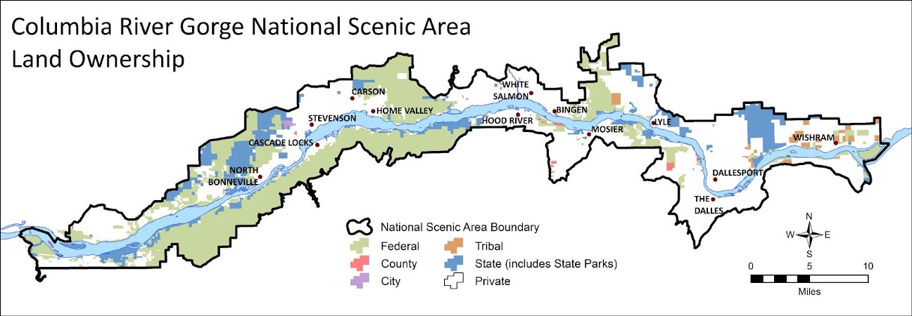
The Gorge Commission is unique among governmental planning entities due to the complexity of ownership within the NSA.

Not only is the Columbia River Gorge NSA the largest in the country, but it is also the most diverse in terms of types of land ownership within the protected area. Most National Scenic Areas are wholly under United States Forest Service (USFS) ownership; in the Gorge, USFS manages about half of the protected area, and the remaining half is a patchwork of private land and federal, state, and local public land. The NSA is located within the ancestral territories of many tribes including the four Columbia River Treaty tribes: the Umatilla, Warm Springs, Yakama, and Nez Perce, and within the boundaries of six counties, three each in Washington and Oregon. This complexity is reflected in the governance of the Commission: of the 13 commissioners, six are selected by the counties, six by the governors of Washington and Oregon, and one non-voting member represents the Forest Service. Currently, three of the Governor-appointed commissioners are tribal members representing the Yakama Nation and the Confederated Tribes of the Warm Springs. The Commission is chaired by is Carina Miller, a member of the Confederated Tribes of Warm Springs.

Map of NSA ownership. Image: CRGC


Land use regulations to protect critical resources and values within the NSA are set forth in the Management Plan for the Columbia River Gorge National Scenic Area, which is updated every 5-10 years.

When the Columbia River Gorge National Scenic Area Act was passed, Congress required a management plan to ensure land use in the NSA would be consistent with the purposes and standards of the Act. The plan defines three management areas: “Urban”, “Special”, and “General”. Special Management Area land use policy is set by USFS; these lands contain some of the Gorge’s most sensitive resources like waterfalls, wildflower meadows, and similar areas in need of the highest level of protection. General Management Area lands, including lands used for farming and ranching, public recreation, and rural residential development, are overseen by the CRGC. The Commission does not regulate forest practices; rather, these fall under the WA and OR State Forest Practices Acts. The Act also required Gorge counties to adopt land use ordinances consistent with the management plan or to have the Gorge Commission adopt and administer one for NSA lands in that county. The NSA management plan does not apply within the 13 designated Urban Areas (the cities and towns within the NSA) or to lands held in trust by the Bureau of Indian Affairs. 

The latest update of the management plan coincided with the Eagle Creek Fire in 2017, bringing an increased focus on climate change and wildfire.

As the Gorge Commission and USFS began the management plan update, some stakeholders and members of the public identified climate change as a key concern. At the time, there wasn’t a shared understanding among commissioners about climate change and what climate-related actions would be most helpful. The Eagle Creek fire in September 2017 brought the effects of the Gorge’s steep slopes and high winds on wildfires into stark relief. This wildfire, along with extreme heat events and additional large fires in 2020 and 2021, put into context the changes Gorge residents could see and feel around them. This helped generate conversation with different landowners and stakeholders, ranging from county commissioners to agricultural producers who were seeing fire on their lands and experiencing the impacts of heat stress on their crops. As a result, the revised management plan includes a climate change chapter directing the Gorge Commission to create an action plan to focus on policies it can implement through its role as a regulatory land use agency. 

The Commission's updated Climate Action Plan priorities. Image: CRGC
Trail restoration at Eagle Creek in 2019. Photo: US Forest Service

The Gorge Commission adopted two goals within its Climate Change Action Plan to address fire risk. These reflect both community concerns and the need for fire adaptation actions to be flexible:

  1. By 2025, combined efforts on public and private lands in the NSA result in at least 2,200 acres of fuel reduction treatments.
  2. By 2030, at least six community-based groups in the NSA are leading community fire adaptation efforts to prepare for, respond to, and recover from wildfire. 

As of 2023, accomplishments toward achieving these goals include:

  • 1,900 treated acres on National Forest System lands;
  • As part of its efforts to engage community members in the Climate Change Action Plan, the Gorge Commission launched the Columbia Gorge Climate Stewards training program in the Fall of 2023. Sixteen students learned about climate change impacts, communication methods, and local efforts to advance community and ecosystem resilience.
  • CRGC participated in the WAFAC annual meeting, gave a presentation about climate action planning and wildfire risk, and learned about fire mitigation and adaptation practices from other WAFAC members.
 

“The Eagle Creek fire demonstrated that wildfire is an issue which  impacts many of the resources the Commission focuses on whether scenic, economic, or ecological.” – Lisa Naas Cook

Fire risk became a priority in the Commission’s Climate Change Action Plan, bringing together the Gorge Commission and WAFAC. Participation in the WAFAC Network connects the Gorge Commission to crucial resources for exploring and refining its role in supporting fire adapted communities.

While drafting the Climate Change Action Plan, the Gorge Commission hosted a virtual forest resilience workshop where staff and several Commissioners met others working on fire adaptation, including Hilary Lundgren of the Washington Resource Conservation and Development Council. Learning about Fire Adapted Communities spurred discussions about the Gorge Commission’s role in and opportunities to incorporate FAC practices in the Gorge. Further conversations with WAFAC staff and member Mount Adams Resource Stewards (MARS) gave the Gorge Commission additional insight into ways to support FAC as a land use planning agency, rather than a direct land manager like USFS or private landowners. 

Learning about the “FAC Wheel” and the different ways that organizations and individuals can engage in fire adaptation helped the Gorge Commission identify multiple options to support FAC practices in their place. Initially, the primary driver in joining WAFAC was to learn what strategies agencies and communities are using and to look at fire adaptation holistically. Now, discussions are emerging around the Gorge Commission’s potential role as a convener and supporter of FAC, given that they are the only entity whose purview includes the entire NSA. Although no one in the Gorge is yet filling that role at a regional level, it’s important to consider whether a regulatory agency is best suited to bring communities together. 

Lisa Naas Cook describes different actions on the Fire Adapted Communities wheel. While the building codes and land use wedges of the wheel might be the best fit for the Gorge Commission, there’s also an opportunity to get involved in other aspects, like a growing smoke monitoring effort in the Gorge. Photo: Jason O’Brien, OSU Extension

Ideally, the Gorge Commission would like to support more coordination and sharing of information across towns and neighborhoods in the NSA, especially on the Oregon side, where there isn’t an organization similar to WAFAC. As a first step towards this goal, the Gorge Commission will have a graduate student fellow working on an inventory of current Fire Adapted Community-related efforts across the Gorge during the summer of 2024. Meanwhile, Gorge Commission staff continue to refine soon to be available resources, like their handout “Protecting Your Home from Wildfires in the Columbia River Gorge National Scenic Area”, and to explore policy options to reduce permitting barriers for fuels reduction and defensible space on private lands in the NSA.

Thanks to Lisa Naas Cook from the Gorge Commission for the conversation and resources. 

Learn More

  • For more information about the Columbia River Gorge Commission, and the resources it has created to support landowners in the NSA, visit the resources page on their website.
Share